


Garfield-Union Precinct, Phelps County, Nebraska
About
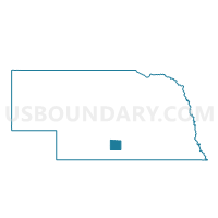
Outline

Summary
| Unique Area Identifier | 613696 |
| Name | Garfield-Union Precinct |
| County | Phelps County |
| State | Nebraska |
| Area (square miles) | 59.43 |
| Land Area (square miles) | 59.43 |
| Water Area (square miles) | 0.00 |
| % of Land Area | 100.00 |
| % of Water Area | 0.00 |
| Latitude of the Internal Point | 40.52461290 |
| Longtitude of the Internal Point | -99.59623630 |
Maps


Graphs
Select a template below for downloading or customizing gragh for Garfield-Union Precinct, Phelps County, Nebraska


Neighbors
Neighoring Voting District (by Name) Neighboring Voting District on the Map
- Bertrand Precinct, Phelps County, NE
- Laird Precinct, Phelps County, NE
- Precinct 3, Gosper County, NE
- Rockfalls-Industry Precinct, Phelps County, NE
- Westmark-Center Precinct, Phelps County, NE
- Westside - Willaimsburg Precinct, Phelps County, NE
Top 10 Neighboring County Subdivision (by Population) Neighboring County Subdivision on the Map
- Garfield township, Phelps County, NE (528)
- Union township, Phelps County, NE (477)
- Industry-Rock Falls township, Phelps County, NE (238)
- Harrison precinct, Gosper County, NE (175)
- Westside township, Phelps County, NE (131)
- Robb precinct, Gosper County, NE (125)
- Lincoln precinct, Gosper County, NE (79)
- Highland precinct, Gosper County, NE (24)